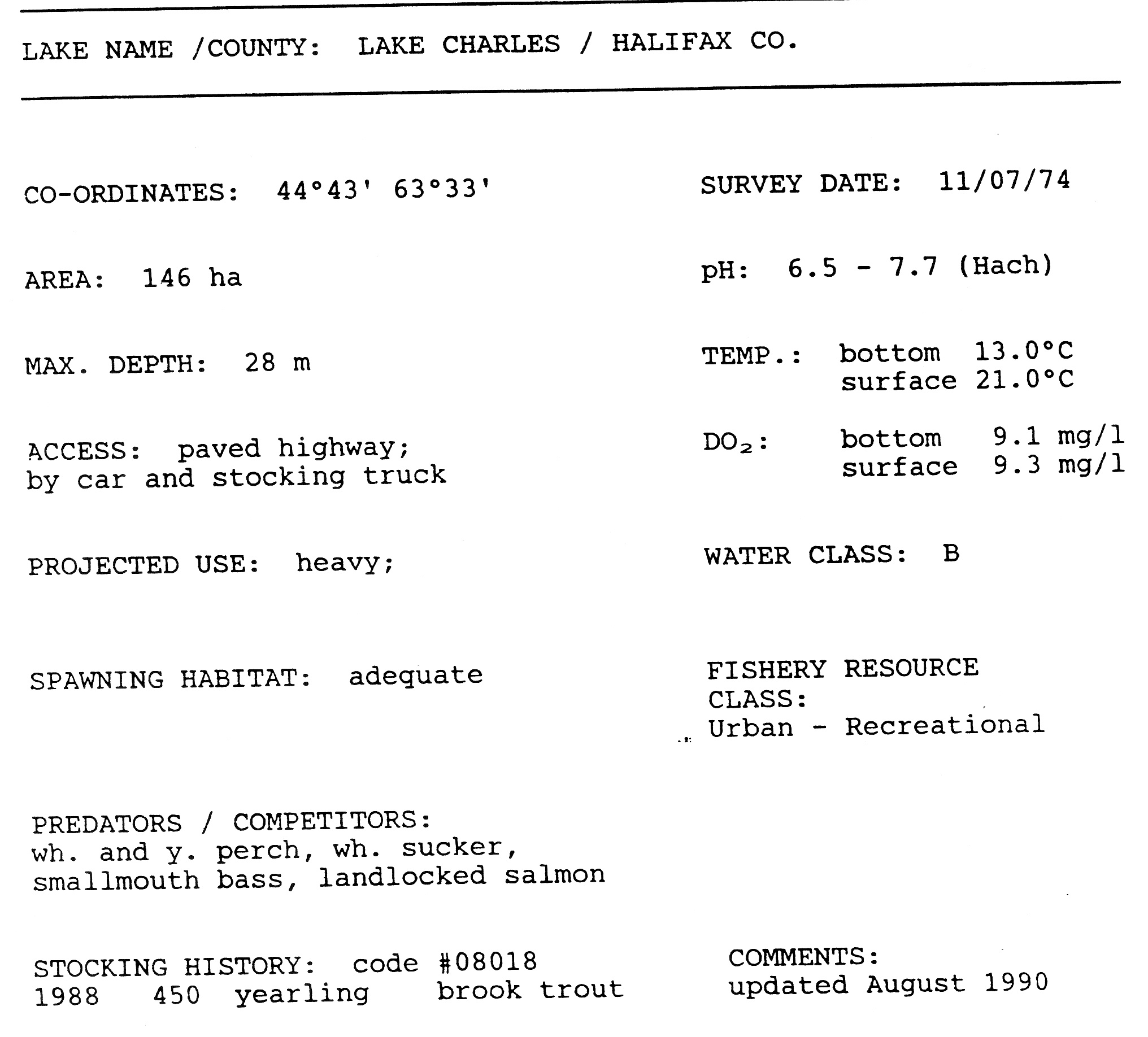
| Lake Charles | |
|---|---|
| Location | Halifax Regional Municipality, Nova Scotia |
| Primary outflows | Shubenacadie Canal Williams Lake 70% Lake Micmac 30% |
| Basin countries | Canada |
| Max. length | 3.24 km |
| Max. width | 0.6 km |
| Surface area | 1.46 km² |
| Average depth | 15 m |
| Max. depth | 28 m |
| Surface elevation | 31 m |
| Frozen | 2 months |
| Islands | 2 |
| Settlements | Dartmouth, Waverley |
Lake Charles is small lake in Nova Scotia’s Halifax Regional Municipality between the communities of Dartmouth and Waverley. Its situated between Port Wallace in the south and Nova Scotia Highway 107 in the North, Nova Scotia Highway 118 in the west and Nova Scotia Route 318 to the east. It’s the summit of Shubenacadie Canal where the level of the surface is 31 meters above sea level . Located in the Shubenacadie watershed, it ultimately feeds into the Bay of Fundy. However it also feeds into Halifax Harbour through the canal locks at Shubie Park.
On the western side of the from Shubie Park to the Highway 107 overpass at Route 318 in Portobello is the Lake Charles Trail part of the Trans Canada Trail . The trail is approximately 2.5 kilometers long and has a crusher dust surface . The trail is used year round and is maintained by the Halifax Regional Municipality .